Posts

Showing posts with the label Transit

Ridership vs Coverage - There *is* a difference...

Image
Jarrett Walker makes the point that public-transit decisions are not made in a vacuum, that there are actual tradeoffs that need to be made between Ridership  and Coverage. If public transit agencies were charged  exclusively  with maximizing their ridership, and all the green benefits that follow from that, they could move their empty buses to run in places where they’d be full.  Every competent transit planner knows how to do this.  Just abandon all service in low-density areas, typically outer suburbs, and shift all these resources to run even more frequent and attractive service where densities are high, such as inner cities.  In lower-density areas, you’d run only narrowly tailored services for brief surges of demand, such as trips to schools at bell-times and commuter express runs from suburban Park-and-Rides to downtown Mind you, this goes dead against the idea of Coverage  - if you told the people who were squawking about "empty trains...
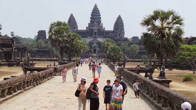
The Angkor Megacity - A *million* people (in the 12th century!)

Image
ArsTechnica has a writeup on the LIDAR mapping of the Angkor region surrounding the Angkor Wat and Angkor Thom complex , and, [Scientists now have] solid evidence that the city of Angkor sprawled over an area of at least 40 to 50 square km. It was home to almost a million people. The scattered, moated complexes like Angkor Wat and Angkor Thom were merely the most enduring features of what we now know was the biggest city on Earth during the 12th and 13th centuries. The best part is that this allows us to cut through the myths and legends around Angkor This transformation of legend into fact has been a theme of the LiDAR surveys. Angkor's huge population is described in temple inscriptions and reports written by Chinese travelers who visited the city during the 12th century reign of King Suryavarman II, who built Angkor Wat. But historical sources are often exaggerated or incomplete. Plus, it was difficult for Western researchers to believe that the Khmer Empire's great...

Frequency and Duration *rule* in Mass Transit

Image
TL;DR --> Frequency and service duration disproportionately effect the value of mass transit, and cuts in them have tremendous network effects making the transit much less valuable .  Think of it this way, if you have to wait an hour for the next train, just take the car. If you can't get back by train, just take the car. Making it worse, if you make do during the week, but can't take the train on weekends, you'll definitely buy a car, and then you'll always have a reason to just take the car in the morning... All this from  an excellent article by Jarret Walker Frequency has three independent benefits for the customer, which helps to explain why high frequency is so critical to sustained high ridership: It reduces waiting, which is everyone’s least favorite part of a trip.  (No, a smartphone that tells you when the bus comes doesn’t solve the problem of waiting; we are still talking about time when you’re not where you want to be.)  The basic se...

Commute times in SF / Seattle / Boulder & Denver - a #Visualization

Image
Remember this transit map that WNYC pulled together in March of 2013? Andrew Hardin, a  graduate student at UC Boulder pulled the data together for San Francisco, Seattle, Boulder, and Denver, and has created the same kind of transit maps for them.  A nice feature here is that you can actually pick the day of the week (yeah boyo, Sunday =/= Monday!) Check it out below! (Visualization below, image above)