Posts

Showing posts with the label Airlines

Airline Flight Delays - Visualized

Image
Via the Guardian , we have this excellent take on flight delays in Australia , based on the raw data from BITRE . I'd like to see the same for the US - but suspect that I already know the answers (hint: anything involving the above airports). On a related note, heres the performance by airline...

Flight Paths - Visualized

Image
Alexey Papulovskiy shows us how its done - collecting data from planefinder.net in October and charting it.   The results are remarkably cool - as the image above of the London regions shows. As he puts it Turns out, besides Flight Levels (FL) (which are indicated on my map by dots’ color: red ones stand for lower altitudes and blue — for higher) planes have pretty specific “roads” and “highways” as well as “intersections” and “junctions”. You can see this for yourself by taking a look at the Russian part of the map: it’s less “crowded”, so the picture is as clear as it gets. The sky above  Moscow area  looks particularly interesting: civil flights are allowed there only since March 2013 and only with an altitude of 27.000 ft or higher Go to the site for an interactive version - its worth the time

Airline Mergers - Visualized

Image
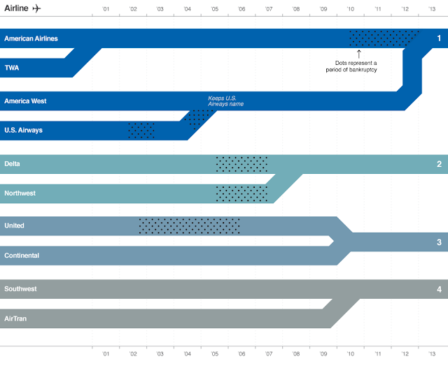
From CNN (Yes. CNN. Go figure.) Its simple, direct, and depressing.  Sigh. (Click to embiggen. A lot)