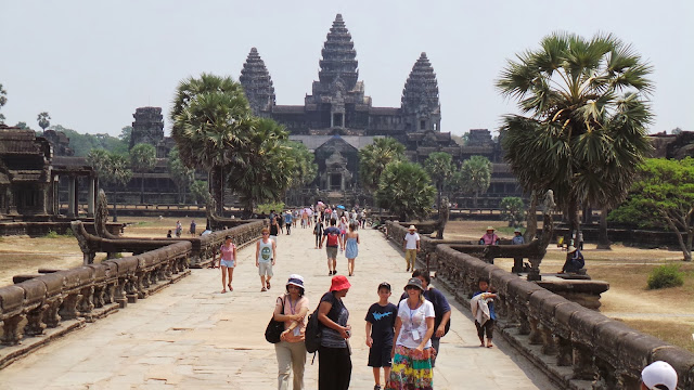
The Angkor Megacity - A *million* people (in the 12th century!)
ArsTechnica has a writeup on the LIDAR mapping of the Angkor region surrounding the Angkor Wat and Angkor Thom complex, and,
 The best part is that this allows us to cut through the myths and legends around Angkor
LIDAR also revealed quiet a bit about how the city was constructed
And about how it came to an end (not with a bang. Just the usual slow decay, a-la Detroit)
[Scientists now have] solid evidence that the city of Angkor sprawled over an area of at least 40 to 50 square km. It was home to almost a million people. The scattered, moated complexes like Angkor Wat and Angkor Thom were merely the most enduring features of what we now know was the biggest city on Earth during the 12th and 13th centuries.
 The best part is that this allows us to cut through the myths and legends around Angkor
This transformation of legend into fact has been a theme of the LiDAR surveys. Angkor's huge population is described in temple inscriptions and reports written by Chinese travelers who visited the city during the 12th century reign of King Suryavarman II, who built Angkor Wat. But historical sources are often exaggerated or incomplete. Plus, it was difficult for Western researchers to believe that the Khmer Empire's great city was home to almost a million people, dwarfing European cities of the same era. Now, such facts are impossible to deny.
LIDAR also revealed quiet a bit about how the city was constructed
The picture that's emerging of Angkor is much like a modern low-density city with mixed use residential and farm areas. As Evans put it to Ars, "in the densely inhabited downtown core there are no fields, but that nice, formally planned city center gradually gives way to an extended agro-urban hinterland where neighborhoods are intermingled with rice-growing areas, and there is no clear distinction between what is 'urban' or 'rural'." The city was a miracle of geoengineering with every acre transformed by human hands, whether for agriculture or architecture.
Perhaps Angkor's greatest technological achievement was its sophisticated waterworks, including artificial canals and reservoirs. People strolling through the city 800 years ago would have passed through neighborhoods whose carefully arranged homes were built alongside rainfall ponds for families, as well as enormous canals for the city as a whole. Massive rectangular reservoirs held water all year around for agricultural use.
Each neighborhood would have looked slightly different, though all relied on the same water infrastructure. The city had to survive the floods of the rainy season and slake the thirst of people and farms in the dry season. For centuries, it accomplished this incredible feat, which modern cities still struggle with. Suryavarman II ruled a city whose mythic proportions were enabled by the most sophisticated engineering techniques of his day.
What the LiDAR reveals is that there were no mass migrations from Angkor to other areas. ... as Heng says, "collapse of a civilization is a long-term process, and it did not happen abruptly." Heng adds that many parts of the city were never abandoned at all, though the gridded regions outside Angkor Wat's enclosure slowly emptied out after the 15th century. "Angkor Wat has never been abandoned," he said. "The temple was still functioning when the French explorers came to visit, and it is still functioning today."Go read the whole thing - its awesome


Comments